4.1 Why a GIS based modeling system is needed
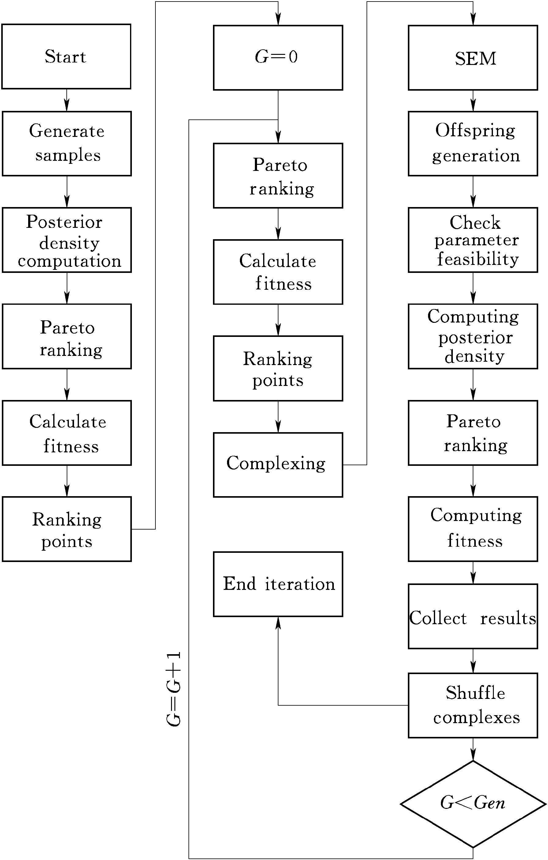
A modeling system can provide functions with data acquisition,processing inputs,manipulation,reporting and display of modeling results and information storage.These functions can be realized by integrating hydrologicalmodels and GIS systems.GIS system has the capability to manage large volumes of data in a common spatial structure.GIS based modeling system can befurther developed by add-ins including software packages and algorithms.GISbased hydrological modeling systems with graphical user interface; GUI enables users to use simplified model manipulations rather than sophisticated modeling steps.Since the appearance of the first hydrological model called the Stanford Watershed Model (Crawford and Linsley,1966),many similar modelshave been created and used in various application ...... (共3730字) [阅读本文]>>
 上一篇
上一篇