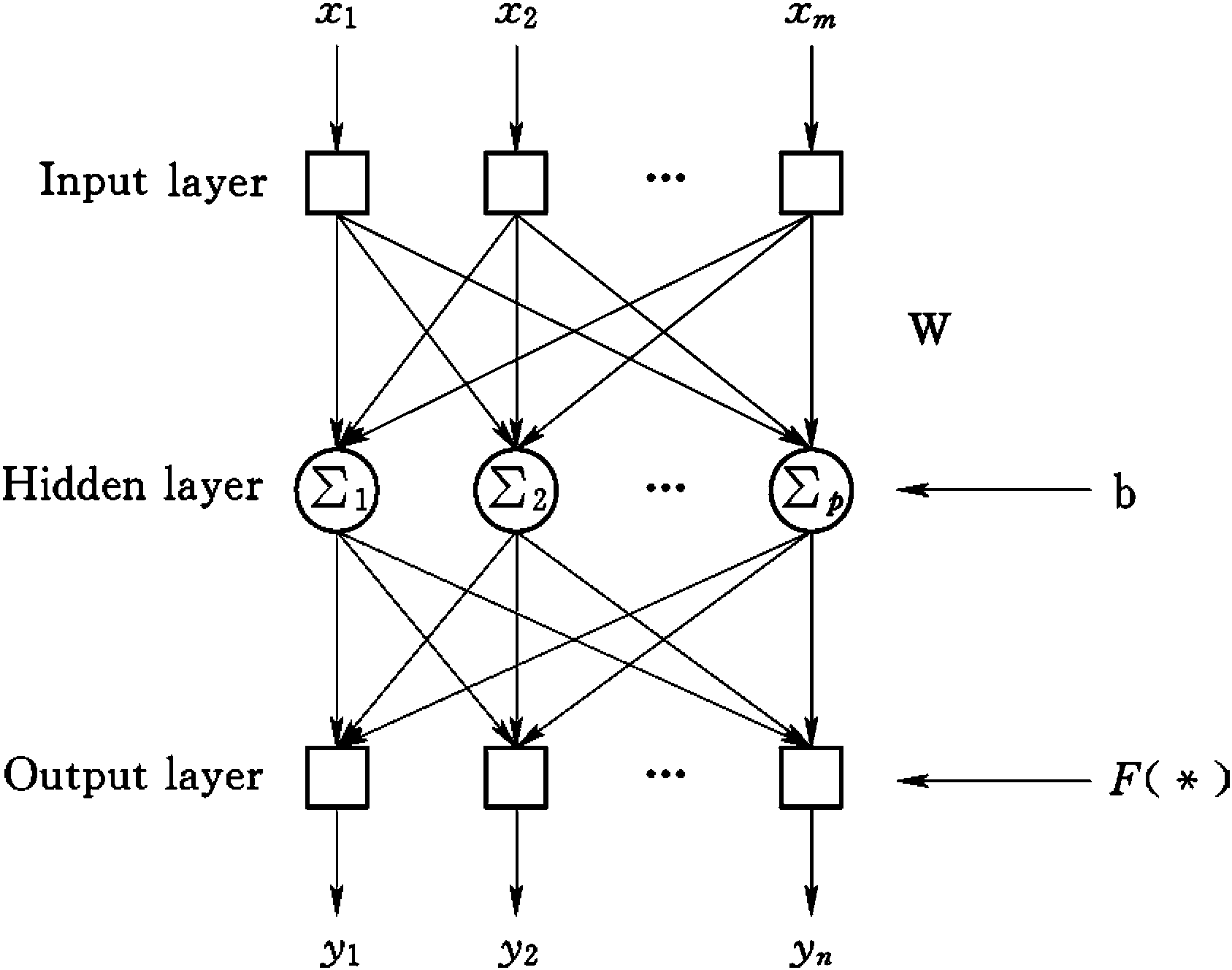
4.7 Meteorological data interpolation
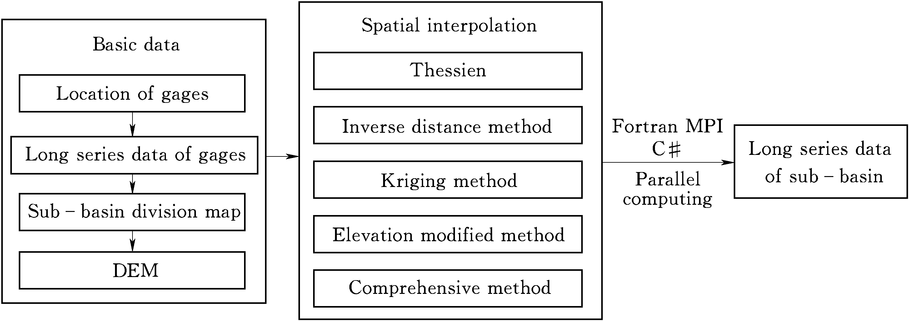
It is necessary to obtain meteorological data from each sub-basin by spatially interpolating meteorological data collected from gauges.Figure 4-7shows the calculation flow chart for the spatial interpolation of meteorologicaldata.Meteorological data interpolation algorithms,including Thiessen polygon(TP),inverse distance interpolation (ID),Kriging interpolation method(KI),elevation modified inverse distance interpolation or a hybrid method(Zhou et al.,2006) should be selected for purpose.It always takes muchcomputing time to implement spatial interpolation for long-term meteorological data.In order to solve this problem,Fortran MPI parallel technology ormulti-threading technology can be used to realize fast interpolation of meteorological data.The basic idea of parallel comput ...... (共1211字) [阅读本文]>>
 上一篇
上一篇