6.1 Study area
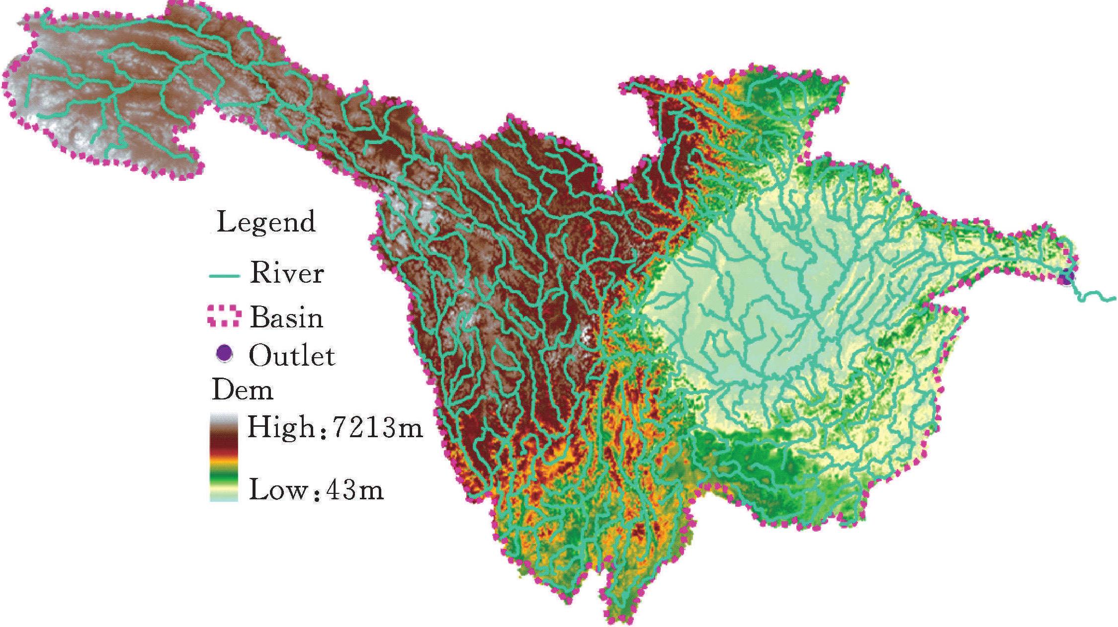
UYR region is located in west highland geographical region of China (Figure 6-1).It is characterized with abundant water quantity and land resourcespotential.The river originates from Qinghai-Tibetan plateau.Drainage areacovers approximately 983000km2 (Latitude: 25.4°-35.8°N,Longtitude:90.5°-111.6°E).Highlands make major parts,particularly in the northwest.Five major drainage basins are Yalong,Jinsha,Mintuo,Jialing andWujiang Rivers.Elevation ranges from 3000m to 5000m.Climate varies acrossthe region.Wet season lasts from April to September.Extreme hydrologicalevent occurs frequently basin-wide.Flood is caused by the variability of monsoon weather pattern which brings about 80% precipitation in wet season.Onthe contrary,droughts are the major hydrological events in sou ...... (共926字) [阅读本文]>>
 上一篇
上一篇